Bangladesh S2S forecast
Weather Impact is working on a project to operationalize seasonal to sub seasonal weather information for Bangladesh Meteorological Department. This forecast is issued each Sunday, and is valid for 4 weeks.
This webpage displays a forecast for the coming week (week1), a forecast for one week from now(week2) and an outlook for the rest of the month (week3+4), which is updated every week.
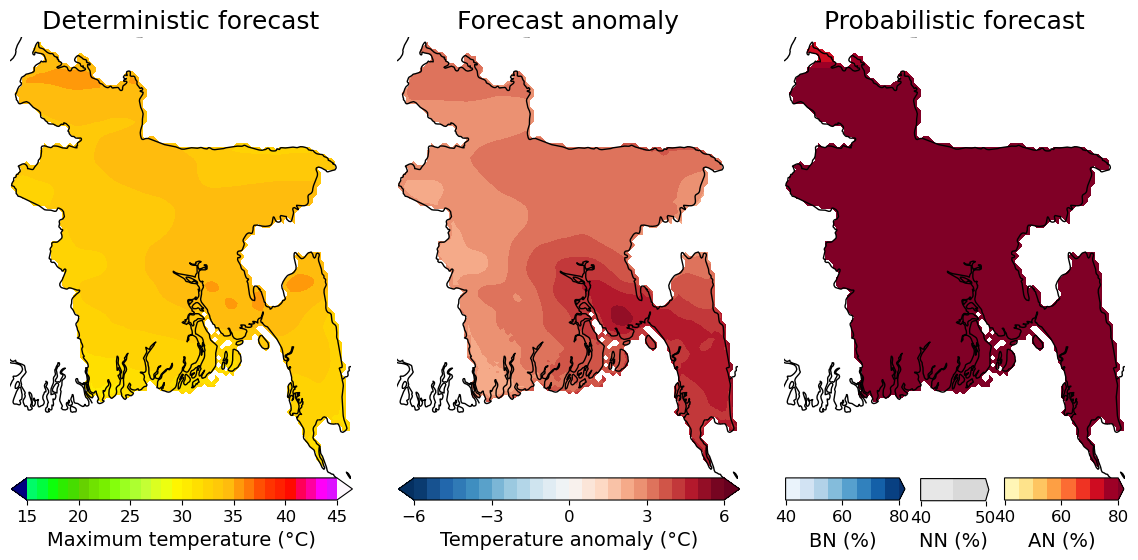
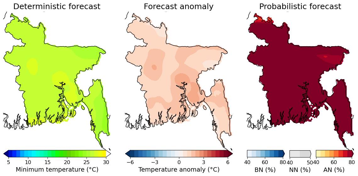
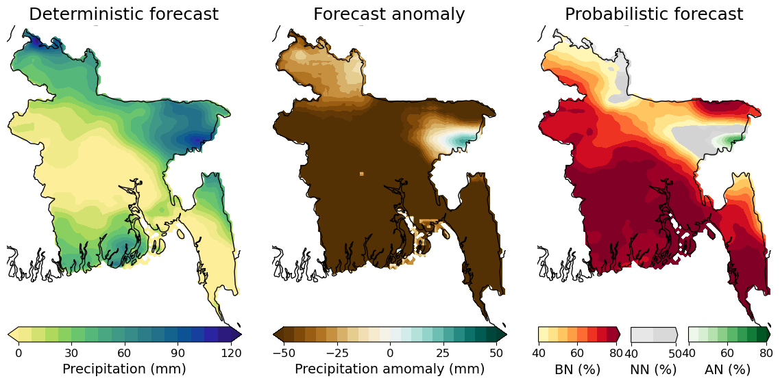
The following three parameters are visualized:
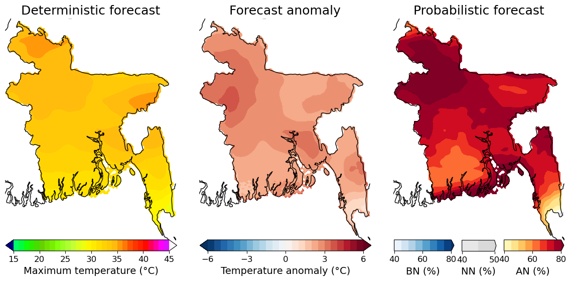
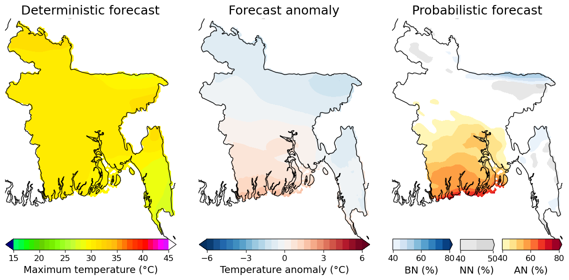
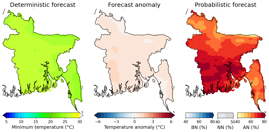
- T max: the maximum temperature in °C
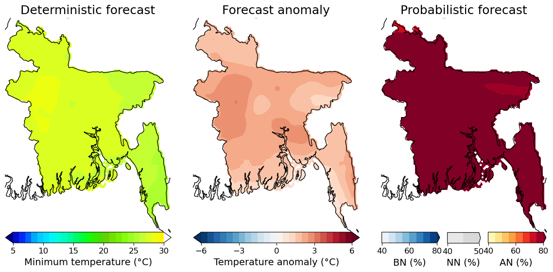
- T min: the minimum temperature in °C
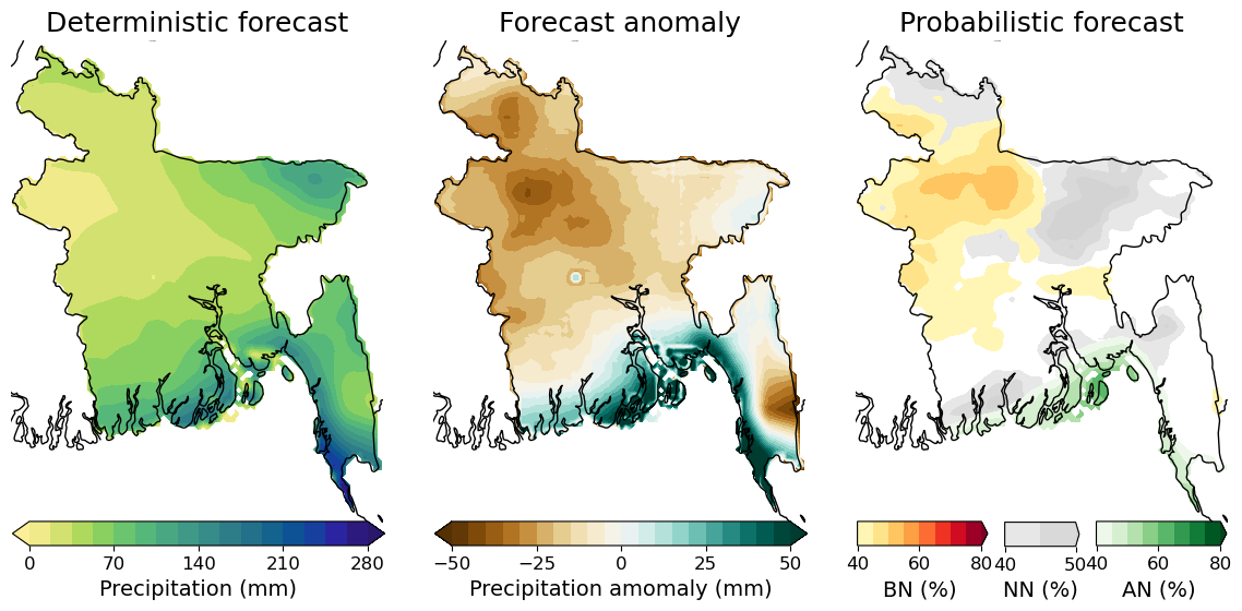
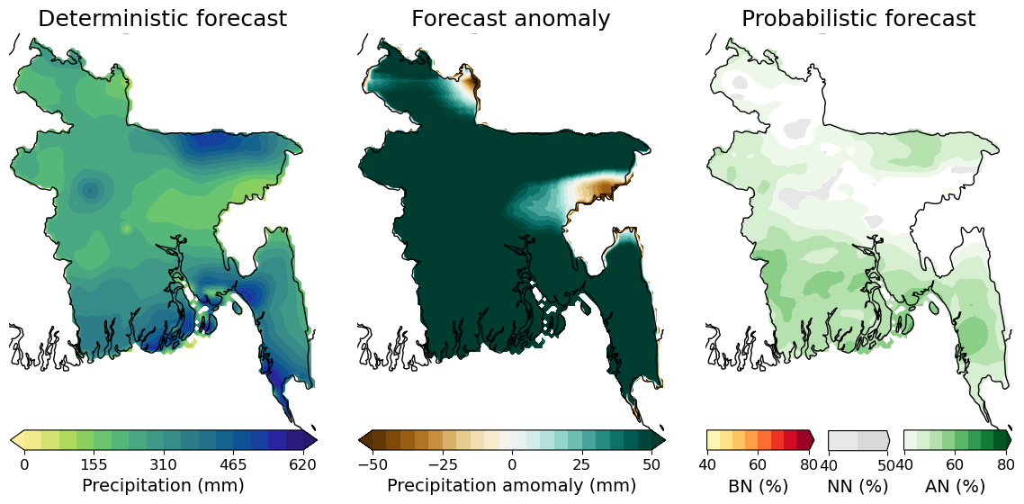
- P amount: the total precipitation amount over the period in mm
For each variable three displays of the forecast are available:
- Deterministic forecast, which is the average value of several members
- Forecast anomaly, which is how much the value deviates from the climatology for that week
- P Probabilistic forecast, which displays whether the value is below normal(BN), near normal (NN), or above normal (AN), compared to the climatology and what the chance is that this is correct (confidence in %)
Week 1 (Period: 07.07.2023 to 13.07.2023)
T max
T min
Rainfall
Week 2 (Period: 14.07.2023 to 20.07.2023)
T max
T min
Rainfall
Week 3+4 (Period: 21.07.2023 to 03.08.2023)
T max
T min
Rainfall
MJO phase diagram (beta)
The figure below shows the time evolution of the Madden-Julian-Oscillation phase. This oscillation has a period of 30-60 days. The light green line represents the ensemble forecast for the next 15 days, which is preceded by the historic MJO phase of the last 40 days. Each preceding month is distinguished by a distinct color, and the accompanying numbers indicate the corresponding dates within their respective months. The yellow lines represent ensemble members.
When the phase is 3, 4, or 5, wetter than normal conditions can be expected. In phases 6,7 and 8, conditions are likely to be drier than normal. For example, the phase on the 10th of June is 3. This diagram is updated every three days.

Jointly prepared by BMD, DAE, Weather Impact-Netherlands, Wageningen Environmental Research and Digital Innovation for Impact (Dii-Dhaka) under BWCSRP (Component-C), supported by World Bank